


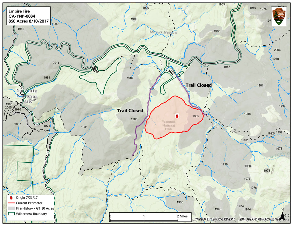
Empire Fire in Yosemite National Park
Note: Click Here for Sunday's Information on the Empire Fire in Yosemite National Park
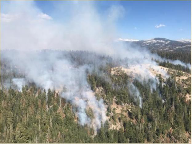
August 21, 2017 - Yosemite National Park fire and aviation crews have responded to multiple lightning-caused wildfires located within the park boundary.
Lightning-caused wildfires are a common occurrence. There have been a total of 10 lightning-caused wildfires since July 31, 2017. One fire currently in monitor status is the Empire Wildfire. Which is currently being managed for resource and protection objectives.
Monitoring a wildfire is a fire management tactic used by fire managers when strategizing an incident response, and contributing factors that help steer this decision-making process are often incident specific. Location, available resources, predicted weather, topography, air quality and predicted fire behavior are all factors that contribute to fire management decisions.
Update Sunday Evening: Size: 1,750 Acres
Basic Information
| Current as of | 8/20/2017, 5:32:16 PM |
|---|---|
| Incident Type | Wildfire |
| Cause | Lightning/natural |
| Date of Origin | Tuesday August 01st, 2017 approx. 08:45 AM |
| Location | 1 Mile South of Bridalveil Campground in Yosemite's Wilderness |
| Incident Commander | Stephen Grater ICT3 |
| Incident Description | Management |
Current Situation
| Total Personnel | 32 |
|---|---|
| Size | 1,750 Acres |
| Fuels Involved | Red Fir Timber (Litter and Understory), Dormant Brush, Hardwood Slash Pockets of green leaf manzanita and chinquapin brush as well as heavy dead and down material |
| Significant Events | Trails are closed from Bridalveil Creek campground to the second junction with the Ostrander trail. Additionally, from Westfall Meadow to the Deer Camp junction, along Alder Creek remains closed. Signs are placed at the affected trails. There are no threats at this time to infrastructure at Bridalveil Campground and the remainder of hiking trails in the area remain open at this time. The smoke will be visible from the high country and may be seen from multiple viewpoints in the immediate area off Glacier Point Road. |
Outlook
| Planned Actions | Continue to hold and improve existing trails and lines. |
|---|---|
| Projected Incident Activity | 12 hours: The southwest side of the fire continues to work it's way south along Alder Creek Drainage. 24 hours: Crews are checking fire spread at Alder Creek 48 hours: Same 72 hours: Continue to improve contingency lines along Alder Creek Trail |
Current Weather
| Weather Concerns | A week area of low pressure will remain anchored off the southern California coast through Wednesday and bring a threat of thunderstorms to the district each afternoon and evening. Generally light slope and terrain winds can be expected through the period. However, winds will be gusty and erratic in the vicinity of thunderstorms. Little diurnal change in temperatures and humidities is expected through the period. |
|---|
- Fire Information: Yose_Fire_Info@nps.gov
- Facebook: https://www.facebook.com/YosemiteNPS/
- Twitter: https://twitter.com/YosemiteNPS
- Air Quality: https://www.nps.gov/yose/learn/nature/aqmonitoring.htm and https://airnow.gov/index.cfm?action=airnow.local_city&mapcenter=0&cityid=533
For smoke and air quality information as it relates to both the Empire Fire and Butte Fire on the Sierra National Forest visit : https://wildlandfiresmoke.net/outlooks/2017/CentralSierraFires#Main

