
October 10, 2018 - SONORA, Calif. — The Stanislaus National Forest provides the following information about a planned prescribed burn on the forest.
![]() General and Specific Location: Jawbone Understory Burn, Groveland Ranger District.
General and Specific Location: Jawbone Understory Burn, Groveland Ranger District.
This specific project is located entirely within Groveland Ranger District Boundary, Tuolumne County in the following legal locations: Township 1 North, Range 17 East, sections 24, 25 & 36; Township 1 North, Range 18 East, sections 19, 29, 30, 31 & 32; Township 1 South, Range 17 East, section 1; Township 1 South, Range 18 East, sections 5 & 6. (A vicinity map may be viewed online at https://www.fs.usda.gov/news/stanislaus/news-events.) This project is a planned prescribed fire. Please do not report as a wildland fire. View vicinity map of prescribed burn.
Projected Duration: Ignition of the prescribed burn is expected to begin late October of 2018, and is contingent on weather, fuel moisture, and air quality. Ignitions could continue up to 11 days or as conditions allow. All burning is monitored and conducted in accordance with state and county air quality guidelines and closely coordinated with local county air quality control districts.
Planned Size of Prescribed Burn: Total of up to 1,676 acres to be treated with low-intensity fire, with planned ignition on approximately 50-150 acres daily. Size of burn may vary with weather and fuel moisture conditions, as well as permissible air quality burn days.
Type of Prescribed Burn: Broadcast underburn
Burn Project Objectives: The goal of this prescribed burn is to improve wildlife habitat. Secondary benefits include enhancing public and firefighter safety by reducing the build-up of dead and down fuels and to reduce the threat of high-intensity wildfire while protecting watershed values and wildlife habitat by creating a mosaic pattern of vegetation.
Public Benefits: Prescribed burning is an effective, cost efficient method of reducing flammable forest fuels, improving firefighting capabilities, and reducing the impacts of large uncontrolled damaging wildland fires. Smoke may be visible from highways 4, 108 or 120 and surrounding communities. Fire managers are working closely with local air districts and the California Air Resources Board to mitigate the effects of smoke on the public. 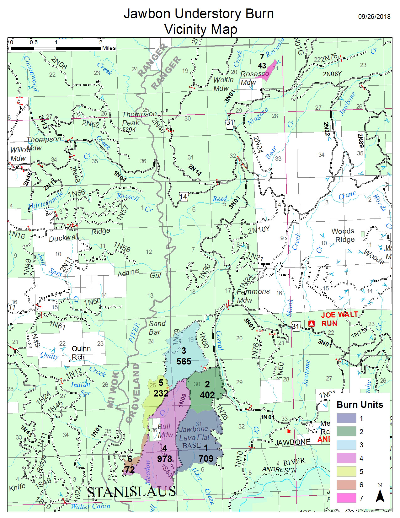
Source: Stanislaus National Forest