
California and National Drought Summary for October 27, 2020
Summary
October 29, 2020 - A blast of frigid Arctic air invaded the North Central States, producing weekly temperatures averaging 15 to 25 degrees F below normal in Montana, the Dakotas, Wyoming, Minnesota, Iowa, and Nebraska. The chill was accompanied by a slow-moving storm system that produced light snow across most of the Rockies, Plains, and upper Midwest. Although outdoor conditions were harsh, the storm and cold were welcome as it brought a halt to the abnormal warmth and dryness that had expanded and deepened the drought in the region. In the southern Plains, mixed precipitation (snow, sleet, freezing rain, and rain) glazed portions of New Mexico, western Texas, Oklahoma, and Kansas, while beneficial moderate to heavy rains fell from southwestern Oklahoma northeastward into the eastern Great Lakes region. Heavy rains also were measured in the western Great Lakes region and south Florida. Scattered, light precipitation was measured across most of the Pacific Northwest, Southeast, Midwest, and western portions of the Northeast. Much of the Southwest and Intermountain West was dry, with wild fires still burning across California. In addition, little or no precipitation fell on the southern Plains, parts of the Southeast, and eastern sections of the Northeast. Above normal temperatures enveloped the Southwest, southern Plains, and eastern third of the Nation. At the end of the period, all eyes were on Hurricane Zeta in the Gulf of Mexico as it tracked toward yet another Louisiana landfall.
Northeast
After several weeks of wet weather and some improvements, most of New England was dry this week as the rains were limited to western sections of the Northeast. Unfortunately, much of Pennsylvania was also dry, and had missed out on the surplus precipitation that New England had received earlier in October. As a result, D2 was slightly expanded eastward, D1 was redrawn in southwestern Pennsylvania to better line-up with the indices, and D0 was extended eastward into eastern Pennsylvania, and southward into the eastern Panhandle of West Virginia. The 7-day average USGS stream flows were still below (10-24th percentile) to much-below (<10th percentile) normal values, particularly where there was D2 and D3. Since surplus precipitation had recently fallen, no changes were made to New England. In contrast, enough rain (1-3 inches) was observed in far western sections for some improvement, especially along Lake Erie, north of Lake Ontario, and in northern Maine, with stream flows increasing to near or above-normal levels.
Southeast
Scattered light to moderate showers (0.5-2 inches) dampened portions of the Southeast, with the most widespread and highest totals measured in Alabama, northern Georgia, Florida Panhandle, western South Carolina, western and eastern North Carolina, and the southern two-thirds of Virginia. South Florida was drenched with heavy tropical downpours, locally to 10 inches. As a result, the small D0 area in west-central Alabama was erased, but the nearby D0 in southeastern Mississippi expanded slightly. Similarly, little or no rain in eastern Georgia and southwestern South Carolina increased the D0 area to the west and north. A potentially new D0 area in eastern North Carolina (as mentioned last week) did not occur as 0.5-2 inches of rain fell there. Overall, there is no drought in the Southeast, and with Hurricane Zeta primed to make landfall in eastern Louisiana and continue northeastward, additional heavy rains should soak most of the region, keeping drought at bay.
South
A stalled front and the winter storm in the southern Rockies brought beneficial precipitation to portions of the south-central Plains and lower Missouri Valley. With temperatures dropping as the week progressed, light frozen precipitation (freezing rain, sleet, snow) coated parts of western Texas and Oklahoma and southern Kansas, with heavier rains (1.5-4 inches, locally higher) reported from southwestern Oklahoma northeastward into Missouri. Unfortunately, southern and eastern sections of Texas missed out on the rain, and short-term dryness (2-3 months) increased, with an expansion of D0 and D1 in southern and eastern sections, and D2 in south-central Texas. With the ongoing storm in the southern Rockies on Day7 and more precipitation expected, a wait and see approach was made, thus it was status-quo for western Texas and Oklahoma this week. In contrast, welcome rains fell from extreme northern Texas across central Oklahoma and into northwestern Arkansas, providing a 1-category improvement to most areas, and even some small 2-cat improvements in northwestern Arkansas and southwestern Missouri where the rains were the greatest (3.5-5 inches). Elsewhere, the small D0 in southeastern Louisiana was expanded northeastward as the past 2-3 months have brought 25-50% of normal rainfall, creating 4-8 inch deficits. However, Hurricane Zeta is expected to inundate this area as it makes landfall near here, so the D0 should be a memory next week.
Midwest
In addition to the heavy rains in southern Missouri (see South summary), the Rockies storm and a stalled cold front produced moderate to heavy rains (1-3 inches, locally to 5) in the middle Mississippi and Ohio Valleys, and in the western Great Lakes region (eastern Iowa into Wisconsin and Michigan). Light precipitation, some of it in the form of snow in northern locales, fell across the remainder of the Midwest. With the widespread precipitation and low temperatures, there was no deterioration in the region; instead, status-quo or improvements. The 1-category improvements included: southern Missouri; southern, central, and northeastern Illinois; southern and central Indiana; western Ohio; southern and central lower Michigan; east-central Wisconsin; southeastern Minnesota; and the eastern half of Iowa. The lower temperatures, lack of evapotranspiration, and widespread precipitation were ideal for soil moisture recharge where the soils were not frozen. However, there were still some large 6-month deficits (e.g. 8-12 inches in western Iowa) that required plentiful precipitation, and this week’s totals were not impressive (0.25-1 inch), thus D2 and D3 persisted there.
High Plains
A winter storm and frigid air dropped southeastward out of Canada and into the northern and central Rockies early in the period, bringing welcome snows to the mountains, and even at lower elevations of the northern and central Plains. Decent early mountain snows blanketed western and southern Montana, northwestern Wyoming, and parts of southeastern Wyoming, central Colorado, and northern New Mexico. Light to moderate precipitation (mostly snow) also fell on South Dakota and into Minnesota, and parts of western Nebraska. For the most part, the precipitation finally halted the downward deterioration (except for North Dakota) in the region, and actually provided some improvements to western and southern Montana, northwestern and northeastern Wyoming, western South Dakota, southeastern Kansas, and some small D3 to D2 areas in central Colorado where the snows were unusually heavy. In North Dakota, however, precipitation was very light (0-0.25 inches). With indices at 2-3 months and longer (6-months) at D2 or drier, plus field reports of shallow water holes dry, low levels in rivers and larger bodies of water, no regrowth of forages, and poor pastures, an expansion of D1 in the northeast and D2 in central sections was justified.
West
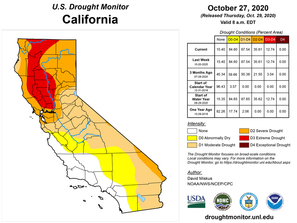
With precipitation limited to western Washington, northern Cascades, northern Idaho, and the Rockies (the Southwest and Intermountain West were dry), only some slight improvements were made. This included central Washington (very slight reduction of D0-D2 on west side), while some D0 was removed in northern Idaho and western Montana as underlying soils were moist, and impressive mountain snows have started the Water Year. No other improvements were done, except for some small D3 to D2 changes in central Colorado due to beneficial storm totals in Huerfano and Costilla counties, and near Ft. Collins and Boulder areas. In the Southwest, California, and Intermountain West, since October is normally dry, temperatures had dropped, and extensive deteriorations had already been made during the past several months, no degradations were made this week. Unfortunately, large wild fires continued to spread and expand in California thanks to gusty Santa Ana winds. As the southern Rockies storm continued past Day7, any additional precipitation and possible improvements after the Tuesday 12 UTC cutoff will have to wait until next week in New Mexico and Colorado.
Alaska, Hawaii, and Puerto Rico
In Alaska, moderate to heavy precipitation (2-6 inches) fell along portions of the southern and southeastern coasts during the week, and during the past 30 days, between 10-20 inches were measured. Accordingly, D0 was removed from southern Valdez-Cordova County. In northwestern Alaska, light precipitation (0.2-0.5 inches) fell, adding to a 30-day total of 0.5-2 inches, thus the eastern D0 edge was erased where the greatest totals occurred.
In Hawaii, decent rains returned to Kauai and Oahu, but with agricultural drought on Kauai and agricultural and hydrologic drought on Oahu, it will take additional rainfall to improve conditions. With the Honolulu Board of Water Supply still under a water conservation notice due to reduced aquifer levels, and the FSA on Kauai saying that pastures need additional rain to recover, status-quo was decided for those two islands. Elsewhere, the Big Island and Maui received less rainfall than Kauai and Oahu, with the State Ag Commission mentioning that pastures near Waimea on the Big Island were at about 50% loss. With similar conditions at South Point, and ranchers supplementing feed and hauling water, D3 was added around Waimea and South Point. On Maui, even though rains were minimal, conditions hadn’t changed much, so status-quo there.
D0 was limited to south-central Puerto Rico after heavy tropical rains erased drought during the summer. During the past 60 days, however, subnormal precipitation has fallen on northwestern, southwestern, and south-central sections, producing short-term deficits of 2-6 inches. As a result, D0 was expanded to include the northwest (Isabela and Quebradillas), southwest (from Cabo Rojo eastward to Ponce), and northwestward from the previous D0 area into Coama, Aibonito, Barranquitas, and Orocovis. USGS 7-day average stream flows also showed much-below normal values across the southern coast.
Pacific Islands
The weather across the U.S.-Affiliated Pacific Islands (USAPI) during this USDM week (10/21/20-10/27/20) was influenced by troughs, weak circulations/tropical disturbances, and trade-wind convergence at the surface; upper-level lows and troughs providing divergence aloft which enhanced precipitation over northern portions of Micronesia; and the ongoing La Niña which kept conditions dry across southern portions of the Federated States of Micronesia (FSM). South of the equator, converging winds, instability, and an oscillating trough brought rain to American Samoa.
Satellite-based estimates of 7-day precipitation (QPE) showed a band of precipitation stretching westward from the Philippines to beyond the Date Line (the climatological Inter-Tropical Convergence Zone [ITCZ]) and another band extending southeast from Indonesia past American Samoa (the climatological South Pacific Convergence Zone [SPCZ]). Within the northern band were areas of 1+ inches of rain across Micronesia between roughly 5 and 12 degrees North latitude, and across the Marianas. Areas of 2+ inches of rain were found within these areas as well as areas with less than half an inch. Bands of 2+ inches of rain were seen on the QPE around and over the Samoan Islands.
Koror, Palau had only 1.77 inches of rain this week, which is slightly below the 2-inches threshold to meet most water needs. However, the monthly rainfall for October is over 18 inches, which is a little over 4 times the monthly threshold to meet most water needs. For this reason, drought free conditions were unchanged for Palau.
This was a wet week for the Marianas, with all three locations receiving over 2 inches of rain. Guam and Rota had the most rainfall this week at 3.46 and 3.41 inches, respectively. Drought is not a concern for the Marianas as all three locations had twice or nearly four times their monthly rainfall threshold of 4 inches.
During this drought week, Pohnpei, Kosrae, Lukunor, Pingelap, and Ulithi had over 2 inches of rain. Kosrae had the most rain at 4.47 inches. Drought free conditions continued across all of these locations. Yap, Chuuk Lagoon, Nukuoro, and Woleai had over 1 inch of rain. Although they didn’t receive their weekly rainfall threshold of 2 inches to meet most water needs, these locations continued in drought free conditions as their monthly rainfall totals were over 8 inches. Fananu and Kapingamarangi had the least precipitation with little rain this week. Kapingamarangi continued in an exceptional drought since it had only 0.24 inch of rain for the week. The October 2020 monthly rainfall total, as of October 27, was only 0.87 inch. According to local reports, 5 of 6 community water tanks were empty, with only one remaining. They believe this tank should be enough to last until another relief boat arrives on the island. The relief boat is scheduled to depart Pohnpei on October 30, 2020 and will be delivering water and supplemental food to Kapingamarangi Islands. Meanwhile, Fananu continued to be drought free since it had over 8 inches of rain for the month.
The Marshalls Islands had a wet week. Kwajalein had the most rainfall this week, receiving over 4 inches of rain. Wotje also had close to 4 inches of rain for the week and the monthly rainfall total was 14.64 inches. According to locals, vegetation is lush and green across Wotje. For this reason, Wotje’s drought classification was improved to drought free status. Majuro had the least rainfall this week at 1.90 inches. However, monthly total rainfall was over 16 inches, indicating drought free conditions.
American Samoa also had a wet week, with rainfall totals ranging from 4 inches to over 6 inches. Monthly totals were over 10 inches. For this reason, drought free conditions remained across American Samoa.
Virgin Islands
This was a dry week for the USVI, with most locations having little to no rain. St. Thomas had only 0.03 inch of rain at the airport and rainfall totals ranged from 0.01-0.08 inch at the different CoCoRaHS stations. The month-to-date rainfall total was at 74.6% of normal precipitation at the Cyril E. King airport. SPI values were indicative of drought free conditions at the 1 and 12 month period, while the 3 and 6 month period were indicative of abnormally dry conditions and moderate drought at the 9 month period.
Similarly, St. Croix had only 0.04 inch of rain at the airport and 0.0-0.33 inch at the different CoCoRaHs locations for the week. The month-to-date rainfall total at the airport was at 63.6% of normal precipitation. SPI values at the 1 and 3 month period were indicative of drought free conditions, while the 6, 9, and 12 month period were indicative of abnormally dry conditions.
St. John had 0.03-0.07 inch of rain, depending on the CoCoRaHs location. However, the month-to-date total at the Windswept Beach was at 123.1% of normal. Most SPI periods (1,3,6, and 12 month) were indicative of drought free conditions, while the 9-month period was indicative of abnormally dry conditions. For this week, all three locations remained in drought free conditions.
Looking Ahead
During the next 5 days (October 29-November 2), WPC’s QPF precipitation focuses on Hurricane Zeta and the southern Rockies upper-air low as they both track northeastward. Heavy rains and strong winds are expected at Zeta’s landfall in eastern Louisiana, then as it weakens, moisture from Zeta will become entrained into the upper-air low, with a band of heavy precipitation (1-4 inches) expected from the south-central Plains northeastward into the mid-Atlantic, and in the southern and central Appalachians. Little or no precipitation is forecast elsewhere across the contiguous U.S., except for some lighter amounts in western Washington, the western Great Lakes region, and Florida. Temperatures will average near to below-normal in the eastern half of the Nation, but above-normal in the West, especially in the Great Basin.
The Climate Prediction Center’s 6-10 day outlook (November 3-7) favors below-normal precipitation across the eastern half of the U.S. and along the southern coast of Alaska, with odds for above-normal precipitation in the Northwest and northern Alaska. Temperatures are anticipated to be above-normal in the West, Plains, upper Midwest, and western Alaska, near-normal in the Southeast and mid-Atlantic, and subnormal in New England and southern and eastern Alaska.
Author(s):
David Miskus, NOAA/NWS/NCEP/CPC
Ahira Sanchez-Lugo, NOAA/NCEI
Dryness Categories
D0 Abnormally Dry—used for areas showing dryness but not yet in drought, or for areas recovering from drought.
Drought Intensity Categories
D1 Moderate Drought
D2 Severe Drought
D3 Extreme Drought
D4 Exceptional Drought
Drought or Dryness Types
S Short-Term, typically less than 6 months (e.g. agricultural, grasslands)
L Long-Term, typically greater than 6 months (e.g. hydrologic, ecologic)

Source: National Drought Mitigation Center