
Incident Update 9:00 A.M.
October 4, 2026 - Yosemite National Park Dome Fire Sunday Morning, October 4, Update: 6,736 Acres with 40% Containment.
Incident Update 9:00 A.M.
October 4, 2026
Location: 1 Mile North of Wawona, CA
Size: 6,736 acres Percent contained: 40%
Cause: Undetermined
Personnel: 811
The Dome Fire was reported on the morning of September 15, 2026. It is in the backcountry of Yosemite National Park and located approximately 1/4 mile north of Chilnualna Falls.
OPERATIONAL UPDATE:
Fire activity increased yesterday as temperatures remained well above normal and conditions stayed dry. Resources were able to limit growth on the spot fires to the northeast with support from aircraft and firefighters on the ground. The most significant increase in fire behavior occurred in the southeast, where both fixed‑wing aircraft and helicopters were used to reinforce suppression efforts. Today, crews will be constructing additional handline on the eastern side and continue addressing the spot fires from previous days. Firefighters will continue structure protection measures at the Ostrander ski hut including the installation of structure wrap. Patrol and mop up continue in the north and south, and crews will continue direct line construction on the west side.
WEATHER:
Partly cloudy skies are likely Sunday as weak low-pressure brushes by to the northwest. Mostly sunny skies are expected Monday and Tuesday. Warm and dry conditions will continue with highs mostly in the 70s and relative humidities are likely to come up slightly with minimums mostly in the 20-30% range.
AIR QUALITY:
Smoke Outlooks with air quality and forecast information are available at:
https://fire.airnow.gov/#7/38.532/-119.416
CLOSURES:
Yosemite National Park is open and operating normally, with the following exceptions. Glacier Point Road is closed due to reduced visibility from smoke and to safely allow firefighting operations. There are no imminent threats to infrastructure. The Four Mile Trail and Panorama Trail, providing access to Glacier Point, will remain open to hikers. Glacier Point Road will reopen when conditions allow. Backpackers already parked overnight at Glacier Point will be allowed to exit after the closure begins. The Chilnualna Falls trail, as well as the trails from the top of Chilnualna Falls toward Buena Vista and Crescent Lakes are closed. Ostrander Trail and all areas and trails south of it are closed. The closure order includes Mono Meadow and Buena Vista trails. The current Dome Fire Safety Closure Map is available at: https://www.nps.gov/yose/learn/management/closures.htm
DRONES AND AVIATION SAFETY:
Unauthorized drones can force firefighting aircraft to stop flying, delay suppression efforts, and allow fires to grow. If you fly, we can't. Help protect firefighters, communities, and our nation's landscapes by keeping your drone away from wildfires. Aviation resources "Own" the airspace around wildfires.
MAP
7:00 A.M. Update
Current Situation
| Total Personnel: | 811 |
|---|---|
| Size | 6,736 Acres |
| Percent of Perimeter Contained | 40% |
| Estimated Containment Date | 10/17/2026 |
| Fuels Involved |
Timber (Litter and Understory) Brush (2 feet) Heavy Logging Slash Red fir fuel type with montane shrub and brush understory interspersed with pockets of non-burnable fuels in granite rock outcrops. Fir trees are large diameter, over 100 ft. tall, and suffer from insect and disease mortality, leading to a significant snag component with large amounts of heavy dead and down coarse woody debris. Most active fire behavior has come from the dense, closed canopy red fir stands, where torching and isolated crown fire pockets have also contributed to spotting. Fuels in 2017 fire footprints have less closed canopy but contain significant dead and down with standing snags, increasing spotting potential. Surface spread rates are lower in the Empire Fire (2017) Footprint, but spotting continues to drive spread. Montane shrubs and brush in the understory are generally available to burn but are not at critical fuel moisture levels. Heavy dead and down fuels are dry, with fuel moisture in 1,000 hr. fuel around 12%. |
| Significant Events |
Moderate, Spotting, Uphill Runs, Single Tree Torching Fire behavior had a marked increase in intensity and spread when the inversion lifted out in Division M near Horizon Ridge. The fire established below Horizon Ridge continued to spread upslope. The fire continues eastward spread toward Ostrander Lake. On the western edge of the fire backing with rollout and falling snags challenge control lines. Fire is backing toward Alder Creek. Jackpots of dead and down fuel within the old burn scar continue to consume and contribute to spotting. With continued dry and warm weather, daily incremental increases of fire behavior are anticipated. |
| Current as of | Sun, 10/04/2026 - 09:32 |
|---|---|
| Incident Time Zone | Pacific Standard Time |
| Incident Type | Wildfire |
| Cause | Under Investigation |
| Date of Origin | |
| Incident Time Zone | Pacific Standard Time |
| Location | North of Wawona Dome |
| Incident Commander | California Complex Incident Management Team 4, Incident Commander Kyle Jacobson. |
| Incident Description | The fire has a moderate rate of spread to the north and northeast. Firefighters have been utilizing natural barriers, and line has been secured on the south and west sides of the fire. The fire is deep in the wilderness and difficult to access due to steep, rugged terrain. |
| Coordinates | 37° 33' 58'' Latitude -119° 36' 82
'' Longitude |
| Planned Actions |
Steep terrain, remote location of the fire, and snags in the 2017 Empire fire scar continue to hamper suppression efforts in Branch 10. Fire continues to move north towards indirect containment line, at or near, the Division K/M break. |
|---|---|
| Projected Incident Activity |
12 hours: Due to poorer overnight recoveries, burning is anticipated to continue well into the evening and overnight hours. Heavy interior fuels will continue to smolder overnight. With lack of pronounced overnight winds, fire spread will be minimal beyond what occurred during the main burning period. 24 hours: With the persistent warming and drying trend, fire activity will incrementally increase through the operational period and following days. Fire spread will generally be terrain driven. Continued spread eastward toward Ostrander Lake around Horizon Ridge and H-17 is possible on the eastern flank. Fire will continue to back down toward Alder Creek on the western flank. With increased receptiveness of fine fuels, spot fires may be more frequent and are a primary driver of fire spread. Heavy dead and down will allow for continuous burning to continue. Indirect control lines may be challenged if reached by fire spread. 48 hours: Continued warming and drying trend will lead to a marked increase in mixing heights. As a result, increased ventilation will lead to further increase in existing fire activity where it occurs. This will allow free burning of interior fuels and further increase the spotting potential. Fire spread that has reached alignment with uphill slopes may lead to areas of active growth. Challenge to existing indirect control lines should be anticipated if reached by fire spread. 72 hours: Continued warm and dry weather. Elevated spotting potential continues. Fire spread that has reached alignment with uphill slopes may lead to areas of active growth. Challenge to existing indirect control lines should be anticipated if reached by fire spread. Anticipated after 72 hours: Continued warm and dry weather. Elevated spotting potential continues. Fire spread that has reached alignment with uphill slopes may lead to areas of active growth. Challenge to existing indirect control lines should be anticipated if reached by fire spread. |
| Remarks |
Glacier Point Road is closed to the public. This safety closure is a result of reduced visibility along the road due to smoke and to safely allow firefighting operations. There are no imminent threats to infrastructure. The Four Mile Trail and Panorama Trail, providing access to Glacier Point, will remain open to hikers. Glacier Point Road will reopen when conditions allow (this is not a season-ending closure). Call 209-372-0200 (then 1,1) for road updates in Yosemite. Other than Glacier Point Road and the associated trail closures mentioned in Box 33, Yosemite N.P. is open and operating normally. Mariposa-Yosemite Airport has been open to the public as of the morning of 10/1. The cause of fire is listed as Undetermined, as investigation continues. The ICP is located at the Mariposa Fairgrounds and a basecamp located at Badger Pass Ski Resort. There are a total of 6 spike camps strategically placed across the fire. CIIMT-4 took command of the incident on 10/02/2026 at 0700. |
| Weather Concerns |
Observed: Mostly clear skies, well above normal temperatures in the 70s and dry conditions with Min RHs in 15-20% have generally been observed across the fire area today. Winds have been mainly terrain driven, from the southwest at 5-10 mph with occasional gusts 10-20 mph. 2-Hour Overnight: Mostly clear skies will prevail, though high clouds are likely to increase around sunrise. Drainage winds, mostly from the east, at 3-6 mph are expected overnight with localized gusts 6-12 mph. Relative humidity recoveries are likely to be slightly higher, but again poor, in the 30-50% range. Low temperatures will be variable, in the upper 40s to near 60 degrees. Smoky conditions are expected in valleys in the vicinity of the fire. 24-72 Hour Forecast: Partly cloudy skies are likely Sunday as weak low pressure brushes by to the northwest. Mostly sunny skies are expected Monday and Tuesday. Warm and dry conditions will continue with highs mostly in the 70s and RHs are likely to come up slightly with minimums mostly in the 20-30% range. RH maximums are likely to be in the 40-60% range. Mixing heights in the afternoons will be greater, peaking on or about Monday. Light drainage winds in the overnights to mornings will become southwest to west 5-10 mph with gusts 10-20 mph each afternoon, with winds trending to be more westerly with time. Expect the inversion to lift around 1000 local time daily. Extended (After 72 Hours): No significant changes are likely until perhaps on or about Saturday October 10th as high pressure remains in place. |
|---|
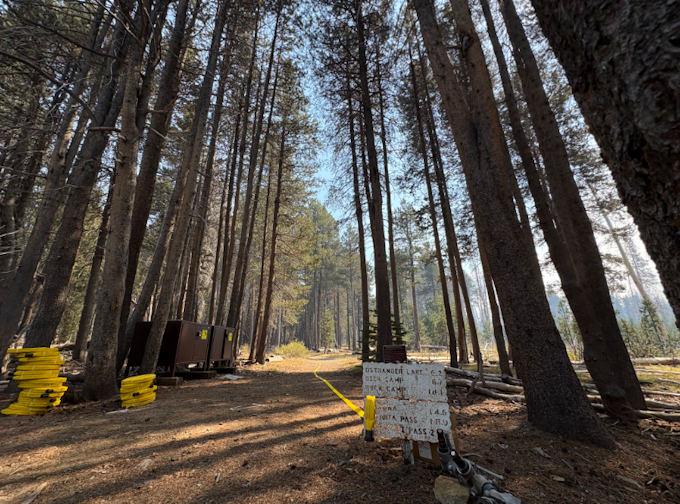
A 1-Mile Long Hose-Lay Stretches from a Trailhead to the Dome Fire
Previous Information