


Note: Click here for Wednesday's Caldor Fire Updates
Caldor Fire West Zone Evening Update Video
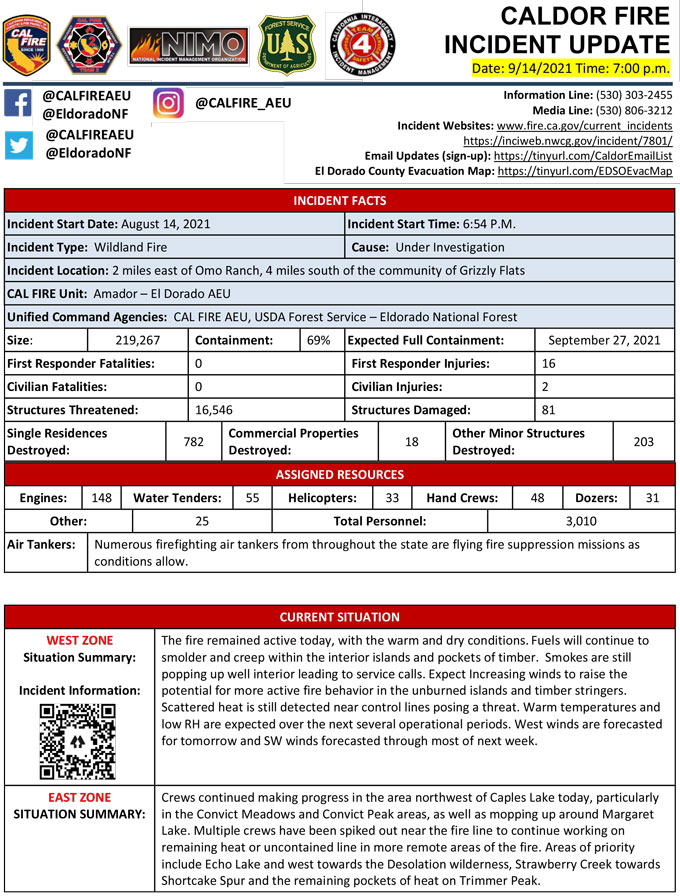
Evening Update Per CAL FIRE: California Caldor Fire is at 219,267 Acres, with 69% Containment, and 3,010 personnel assigned for Tuesday evening.
Evacuation Orders Downgraded - Effective Immediately for El Dorado County
Evacuation Order Update: The following Evacuation Orders have been downgraded to Evacuation Warnings in El Dorado County:
• Crystal Basin B: From Ice House Road east to the border of desolation wilderness and from the Placer County line, south to Granite Springs Road and the area south of Granite Springs Road to Highway 50 at Wrights Lake Road
The following Evacuation Warnings have been lifted in El Dorado County:
• Crystal Basin A: West of Ice House Road, from the Placer County line, South to Highway 50 and East of Junction Reservoir.
• The area of Happy Valley Road from Mt Aukum Road to Cosumnes Mine Road.
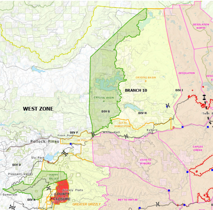
Map below: Red area indicates Evacuation.
Yellow area indicates Evacuation Orders downgraded to Warning.
Update: Evacuation Orders and Road Closures for Alpine County - Effective at 10:00 A.M. September 14, 2021
Caldor Fire Operational Morning Update Video
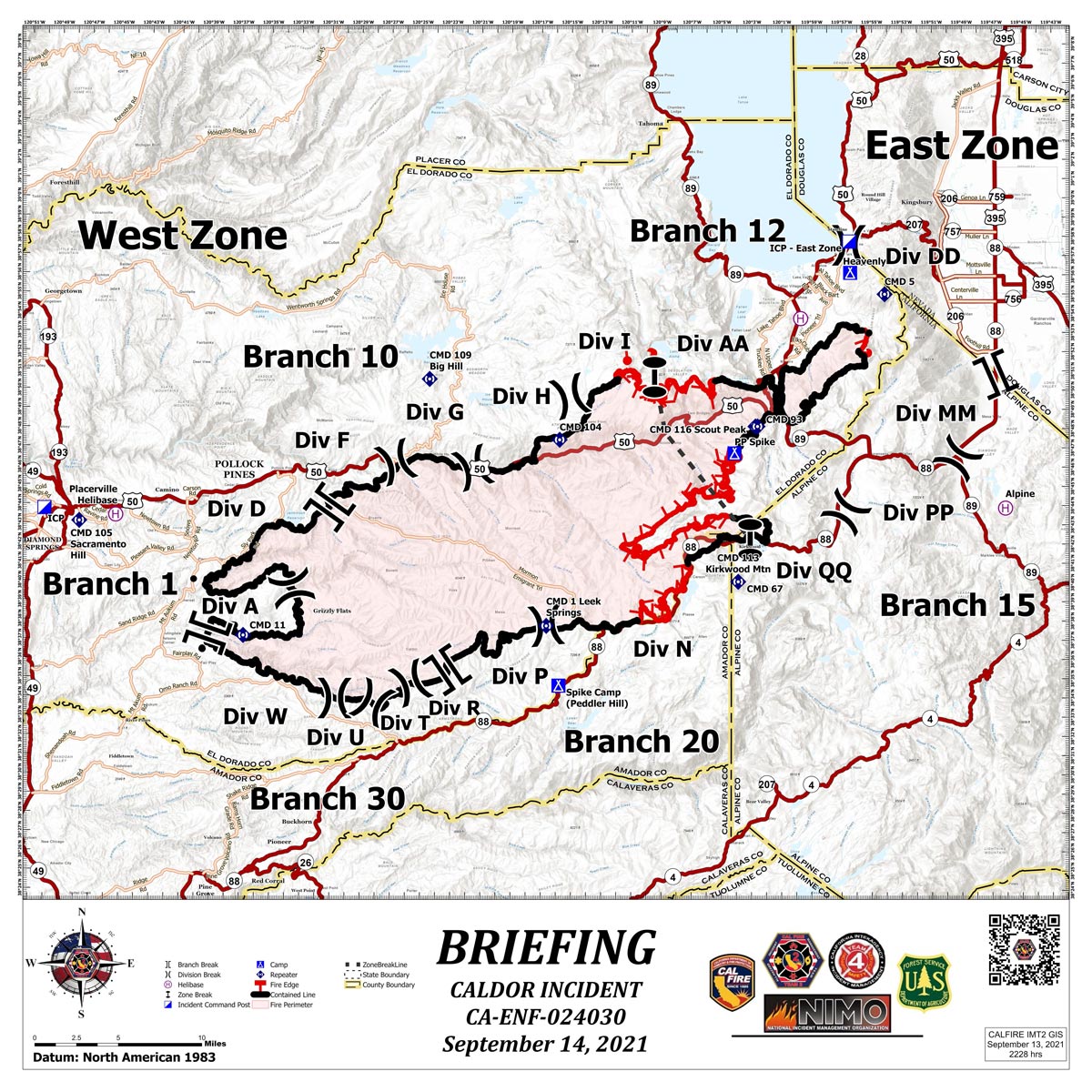
Briefing Map Shows Divisions, Uncontrolled Fire Edge, Completed Dozer Lines.
Note: Map is 1,200 pixels wide.
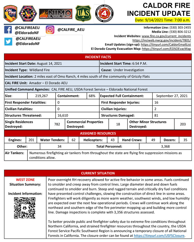
September 14, 2021 - Caldor Fire Update for Tuesday Morning, 219,267 Acres with 68% Containment.
Update CAL FIRE
Click here for: California Caldor Fire Monday, September 13, 2021 Updates

