


July 16, 2019 - By W. Paul Burgess, Rachel A. Beard, Jeremy T. Lancaster, and Robert A. Wurgler - The nascent California “Recent Landslides” database compiled by the California Geological 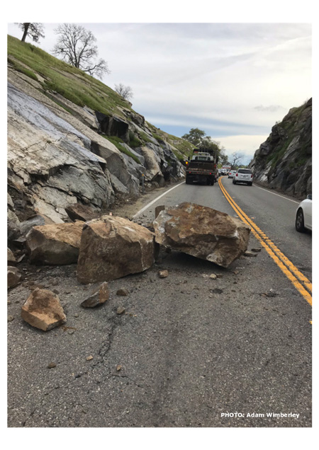 Survey (CGS) is a repository for the collection and communication of recent statewide landslide data. The repository is presented to the public as an online interactive ArcGIS Online map displaying landslide locations and other attributes to show varying scales of landslide processes affecting California's citizens, businesses, and infrastructure.
(Left) Boulders fell onto road on State Route 41 in Madera County (PM 14.1) on March 6, 2019 - Photo credit: Adam Wimberley, Caltrans District 6 Maintenance Supervisor
Landslide events are communicated with seven attribute fields including Landslide Date, Nearest Place, Info Source, Impacts, Damage Description, Latitude, and Longitude, and include (if available) a representative photograph to increase the educational impact of the landslide processes attributed to each event.
With the continued development of this database, the CGS endeavors to reach Californians and California governmental agencies with data useful for education and planning purposes. The development of the "Recent Landslides" database is considered vital to better describing the causes of storm-induced landslides. It is the aim of the CGS to eventually implement the database as a tool to provide statistical insights into frequency of given landslide types.
 Explore the California Recent Reported Landslides Database and Map
Source: CGS

