


September 20, 2026 - Yosemite National Park Dome Fire Sunday Morning Update: 2,667 Acres with 15% Containment.
| Total Personnel: | 525 |
|---|---|
| Size | 2,667 Acres |
| Percent of Perimeter Contained | 15% |
| Fuels Involved |
Standing closed canopy timber is producing active fire behavior and spotting, adjacent fuels become less continuous with scattered timber, brush, grass, and exposed granite hillsides. |
| Significant Events |
Active Fire Behavior was observed with isolated torching, flanking and creeping. Fire has continued to spread to the north and northeast via surface spread in heavy fuels and short to medium range spotting (between ¼ to ½ of a mile). The red fir fuel type has a significant dead and down component and is highly conducive to both ember production as well as ember reception, leading to frequent spotting. Wind alignments from the south and west increase spotting to the north and northeast, with a noteworthy large spot fire established east of Tanner meadow on the SW facing slope. The heavy fuel loading presents resistance to control issues for ground resources, reducing line production rates, though numerous granite outcroppings and bare areas provide some opportunities for using natural barriers. To the north, fire growth is expected to slow as it encounters the footprint of the 2017 Empire Fire. Threats to values at risk and potential fire behavior are greatest as the fire moves downslope to the west and southwest, where heavier mixed conifer fuels increase potential for fire behavior that would challenge ground resources. The fire remains wholly within the wilderness area of Yosemite National Park and is expected to stay that way through the forecast period.
|
| Current as of | Sun, 09/20/2026 - 09:24 |
|---|---|
| Incident Time Zone | Pacific Standard Time |
| Incident Type | Wildfire |
| Cause | Under Investigation |
| Date of Origin | |
| Incident Time Zone | Pacific Standard Time |
| Location | North of Wawona Dome |
| Incident Commander | California Complex Incident Management Team 3, Incident Commander Oscar Vargas. |
| Incident Description | The fire has a moderate rate of spread to the north and northeast. Firefighters have been utilizing natural barriers, and line has been secured on the south and west sides of the fire. The fire is deep in the wilderness and difficult to access due to steep, rugged terrain. |
| Coordinates | 37° 33' 58'' Latitude -119° 36' 82
'' Longitude |
| Planned Actions |
Construct direct handline where topography and fire behavior permit. Establish secondary and contingency lines. Employ rotary-wing aviation assets to check fire spread, moderate flame lengths to thresholds suitable for direct attack. Continue to identify and construct helispots and sling sites to support operational mission. Establish Badger Camp within 48 hours. |
|---|---|
| Projected Incident Activity |
12 hours: Fire remains largely in backing alignment with spotting spread driven by ridge winds. Even moderate to light winds have resulted in frequent spotting. Expect fire to continue to spread to the north and east as daily up canyon and west to southwest winds influence spread direction. 24 hours: Fire remains largely in backing alignment with spotting spread driven by ridge winds. Even moderate to light winds have resulted in frequent spotting. Growth from spots to the north and east will continue as fires established in the drainage below Tanner meadows. Potential for short uphill runs and continued spotting in ref fir fuels remains as fire in drainages responds to the warming and drying trend. Western flank of the fire will continue to back downslope driven by rollout and shortrange spotting. Fire is likely to remain in the Chilnualna drainage along the creek. If it crosses the creek, it will enter the footprint of the 2017 South Fork Fire, where it will be in alignment with slope but out of wind alignment and in an area with less fuel than the current perimeter. 48 hours: Steady northward progression in the 2017 Empire fire footprint will likely bring the fire in the vicinity of Empire Meadow and the northern reach of Alder Creek. If suppression efforts along the west flank are not successful, fire will also likely back down to the main stem of Alder Creek west of current perimeter. This would place the fire in alignment with wind and slope, which combined with the heavier and continuous fuels in this drainage, has the potential to increase fire activity. Eastern spread will be confined to timber stringers and meadows between patches of unburnable rock. |
| Weather Concerns |
Observed: Outside of localized smoke layers, skies will remain sunny today. High temperatures ranged from the mid to upper 60s with relative humidity dropping into the 25–35% range. Winds follow typical terrain-driven patterns, blowing southwest to west at 5–10 mph, with occasional gusts reaching 15 mph on exposed ridge tops. 12-Hour Overnight: Relative humidity is expected to peak this evening in the 60 percent range, with valley inversions developing around midnight. Humidity will then gradually decrease overnight, reaching the mid-30s to mid-40s by morning. Low temperatures will be around 50°F. Typical overnight drainage winds are expected to develop, generally from the east at 4–7 mph, with occasional gusts up to 10 mph. 24-Hour: Little change in temperatures is expected Sunday with highs in the 60s. We will see slightly drier air working into the region with afternoon minimums falling into the mid-20s to around 30 percent. High clouds will move into the region with considerable high clouds expected by the afternoon Winds will be southwest to west at 4–8 mph, with occasional gusts around 12 mph on exposed ridges. 48-Hour: A weak weather system will move through the area Monday, bringing a few more clouds along with a slight chance of afternoon thunderstorms, mainly over the Sierra Crest. Probabilities of wetting rain remains at less than 10 percent. Winds will remain typical, with afternoon southwest winds around 4–8 mph. Temperatures will peak in the lower to mid-60s, while afternoon relative humidity falls into the lower to mid-30s. 72-Hour: High pressure will build back into the region with warming temperatures and drier conditions. Temperatures are expected to be several degrees above normal. |
|---|
CAL FIRE Sunday Morning Update: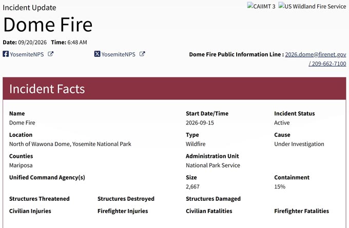
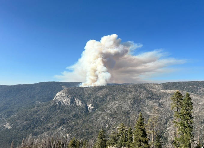
Dome Fire from Wawona Point, Yosemite National Park, 9-16-2026. NPS photo.
Previous Information
