


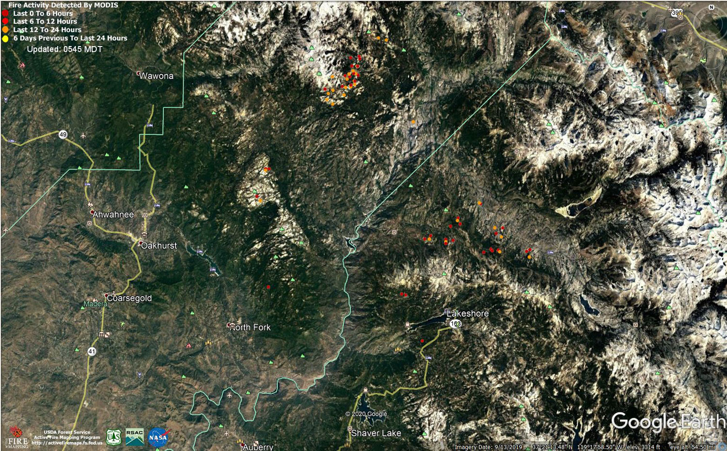
MODIS map of the Creek Fire on Wednesday at 4:45 A.M. PST
Note: 1,500 Wide and older yellow detections removed
MODIS Active Fire Mapping Program Frequently Asked Questions
Update 7:25 P.M. Per CAL FIRE evening update: 307,051 acres and 44% containment.
'Click' here to view 6 page PDF With Evacuations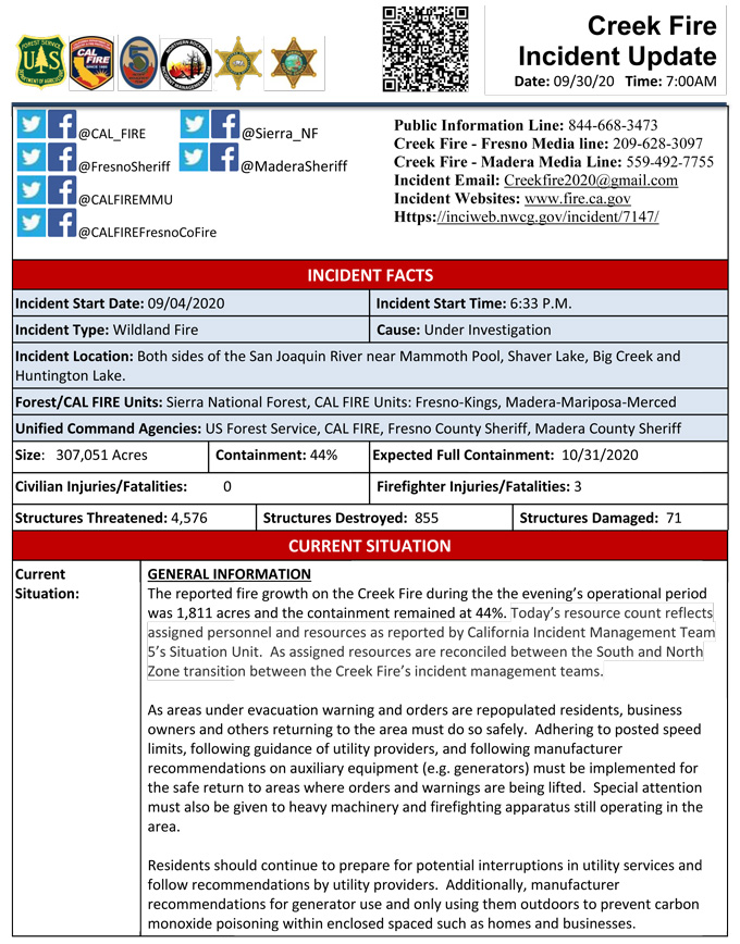
Update 7:00 P.M. LIVE: Sierra National Forest to Hold a Creek Fire Livestream Incident Briefing with CAL FIRE on Wednesday, September 30, 2020
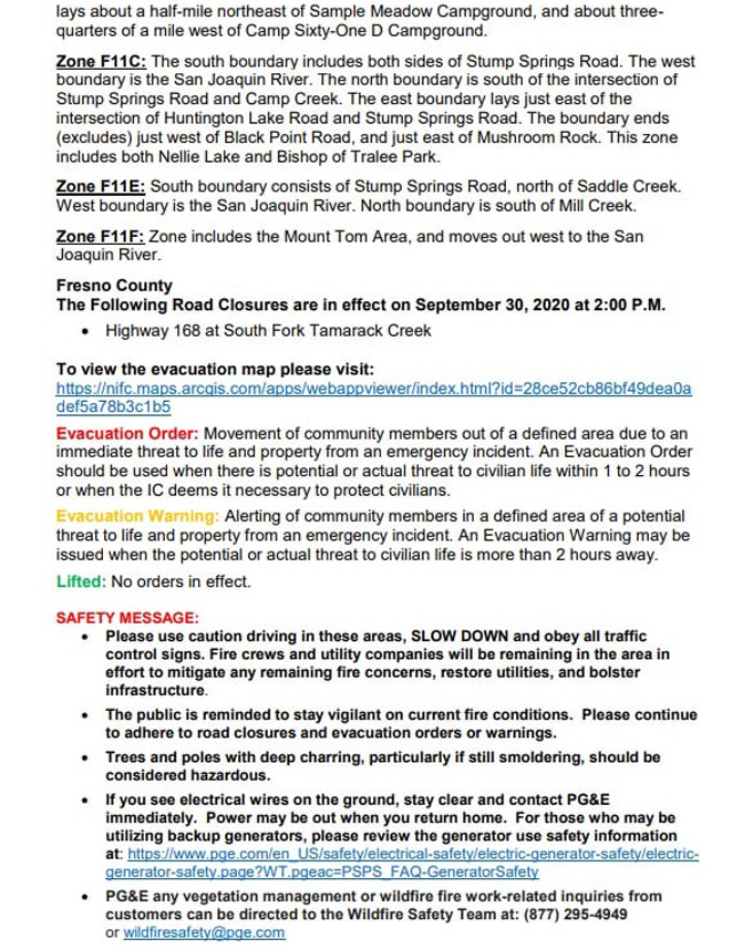
Update 4:00 P.M. Per Fresno County Sheriff's Office: Effective immediately, this allows certain areas to repopulate, lifting evacuation orders in zones F5GB, F6B, F9E, F9H, F11B, F11C, F11E, F11F.
Please view the map to see exactly what zone you are in to determine if you are able to return to your property. Each day, additional zones will be evaluated to determine if they become eligible for repopulation. We will let you know as soon as new zones open up.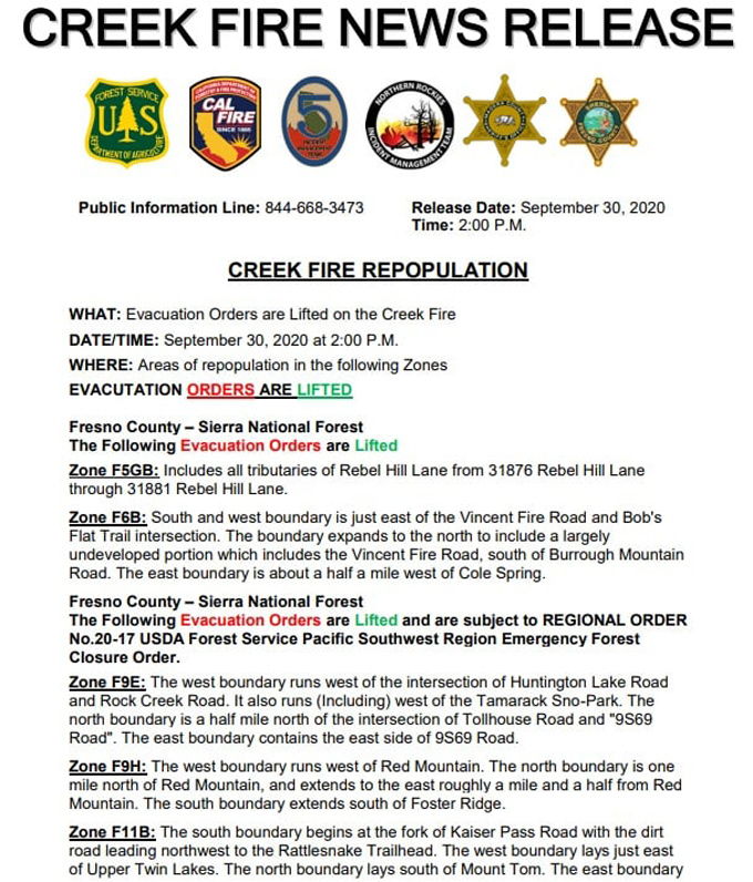
Update 2:15 P.M. Sierra National Forest Creek Fire North Zone Operations Briefing Video For Wednesday, September 30, 2020
Update 12:45 P.M.: CAL FIRE morning update: 307,051 acres and 44% containment, with 4,576 structures threatened.
Note: No PDF Today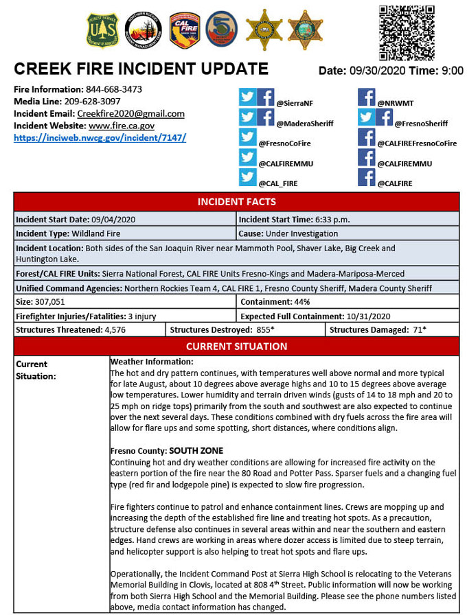
Update 10:45 A.M.: Sierra National Forest Creek Fire Operations South Zone Briefing Video for Wednesday, September 30, 2020
Update: 8:15 A.M. Forest Service Wildland Fire Smoke/Air Quality Outlook Due to the Creek Fire in the Yosemite Area for September 30 & October 1, 2020
Update 7:00 A.M.: Sierra National Forest Creek Fire Progression Map for Wednesday, September 30, 2020
Update 5:10 A.M.: Sierra National Forest Creek Fire Operations Map for Wednesday, September 30, 2020 - Shows Divisions, Uncontrolled Fire Edge, Completed Dozer Lines, Proposed Dozer Lines
September 30, 2020 - Tech issues prevented overnight infrared mapping of the Creek Fire.
Comments and notes on flight:
Tuesday Evening Update: 305,240 acres and 44% containment.
Sierra National Forest Creek Fire Updates for Tuesday, September 29, 2020

